August 24, 2011 — Harvard Humanitarian Initiative Helps Aid Organizations Respond to War, Disasters
Coping with humanitarian emergencies brought on by war, famine, or a natural disaster is rife with challenges. Aid workers can face armed militias, an earthquake-stricken landscape of blocked roads and crumbling buildings, masses of displaced people on the move, or a confusing situation in which dozens of aid organizations are all trying to help at the same time—but are not coordinating with each other.
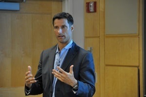
Given the challenges, said Michael VanRooyen, director of the Harvard Humanitarian Initiative (HHI), it’s essential for humanitarian organizations to utilize new technologies that can help with communication, information-gathering, and data analysis. VanRooyen spoke at an HSPH Hot Topics lecture on August 16, 2011.
A research and academic center focused on humanitarian issues, HHI runs a number of programs aimed at helping governments, non-governmental organizations, and the United Nations make the best possible use of the latest technology while delivering humanitarian aid.
VanRooyen, associate professor in the Department of Global Health and Population at HSPH and associate professor of medicine at Harvard Medical School, has aided humanitarian efforts in more than 30 countries affected by war and disaster, including Somalia, Bosnia, Rwanda, Iraq, and Sudan, both as a physician and a policy adviser.
Providing aid can be “a very complicated proposition,” VanRooyen said. “Advances in technology can redefine the way we approach populations.”
Managing Data Streams
The advent of cell phones, e-mail, Skyping, and texting has, in one sense, made it easier to deliver humanitarian assistance. But there’s a flip side: The vast quantities of data now available must be managed and analyzed.
The question, says VanRooyen, is “How do you manage data streams from disparate sources and use them so they actually make sense?” He noted that relief organizations “use cell phones and texting, but they don’t use mapping or crowd-sourced data or very sophisticated ways of tracking logistical movements in the field. They don’t do things like risk modeling of populations.”
HHI helps these organizations figure out how to take information—such as numbers of people injured, numbers displaced, or locations of roadblocks—and represent it graphically or on a map.
HHI is also involved in technology-related policy development. As VanRooyen pointed out, open-source data on the Internet can be extremely helpful for aid workers—for instance, it can provide information about locations of vulnerable populations. But if such information gets into the wrong hands, those populations could be at risk.
“How do you establish security protocol? How do you code data? How do you share it within a certain subset of people?” asked VanRooyen. To address this issue, HHI collaborated with the United Nations on a report that suggests safe ways to handle crowd-sourced data and data mapping.
Another HHI effort enables aid workers to conduct surveys on smart phones. “Surveys used to be done on paper,” said VanRooyen. “You’d get the data, bring it back to an office, collate it, enter the data, analyze it. Months later, you’d get the information from that survey. Now you can get it while you’re in the field.” New digital tools help aid organizations design survey methodologies, create survey tools, aggregate data, and prepare reports.
Using Satellite Images
Aerial views and satellite technology are also bringing a new dimension to the delivery of humanitarian aid, said VanRooyen. From on high, patterns become evident: destruction of villages; mass grave sites; movements of trucks, tanks, helicopters, and troops. HHI collaborates with the Satellite Sentinel Project—founded by actor George Clooney and Enough Project cofounder John Prendergast to deter the resumption of war between North and South Sudan—to analyze satellite imagery, discern patterns, and submit reports for human rights and advocacy purposes.
HHI also tests new technologies during an annual week-long crisis simulation exercise in Harold Parker State Forest, north of Boston. The simulation mimics a real-life crisis by featuring displaced refugees, landmines, armed militias, and border guards. (Read about the simulation.)
The ability to use new technologies to improve the delivery of humanitarian aid makes it a very exciting time in the field, said VanRooyen. “It’s a revolution in the way collect and use data in conflict and disaster,” he said.
–Karen Feldscher
Photo: Aubrey LaMedica
More Hot Topics
HSPH Health Policy Expert Impressed with National Health Reform Implementation — Featuring John McDonough, professor of the practice of public health and director of the Center for Public Health Leadership
Location, Location, Location: Where You Live Can Affect Your Health — Featuring Francine Laden, Mark and Catherine Winkler associate professor of environmental epidemiology
Take It to Heart: Positive Emotions May Be Good for Health — Featuring Laura Kubzansky, associate professor of society, human development, and health
Protecting Children From Adversity Key to Healthy Development — Featuring Jack P. Shonkoff, Julius B. Richmond FAMRI professor of child health and development and director of the Center on the Developing Child at Harvard University